





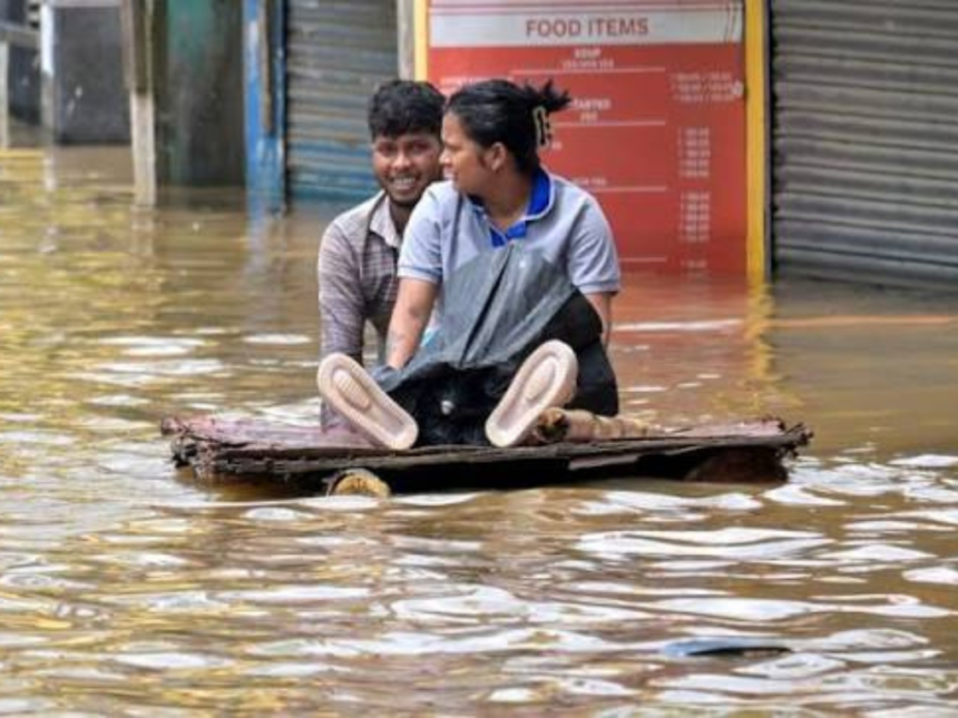
Assam is once again battling severe floods, with the disaster claiming 68 lives and affecting more than 5.24 lakh people across the state. Thousands of families have been forced to leave their homes, while relief camps continue to shelter those displaced by the rising waters. Charaideo district has emerged as one of the worst-hit regions this year, highlighting the scale of the annual crisis.
While floods have become a recurring part of life in Assam, experts say the devastation is caused by a combination of geography, climate, and environmental factors rather than heavy rainfall alone.
At the centre of Assam’s flood problem is the Brahmaputra River, one of the largest and most powerful rivers in the world. The river begins as the Yarlung Tsangpo in Tibet before flowing into Arunachal Pradesh as the Siang and finally entering Assam as the Brahmaputra. By the time it reaches the state, it has already collected enormous amounts of water from glaciers, snowmelt, mountain streams, and rainfall across the eastern Himalayas.
Also Read :- https://x.com/himantabiswa/status/2081281130557546530
Assam’s unique geographical location makes the situation even more challenging. The state lies in a narrow valley surrounded by the Eastern Himalayas, the Patkai and Naga Hills, and the Meghalaya Plateau. During the southwest monsoon, moisture-laden winds from the Bay of Bengal hit these mountain ranges, causing extremely heavy rainfall. The rainwater then rushes down through hundreds of rivers and tributaries before flowing into the Brahmaputra, causing the river to swell rapidly.
Another major reason behind the floods is the huge amount of sand, silt, and rocks carried by the Brahmaputra. The young Himalayan mountains constantly erode, and this sediment gets deposited on the riverbed in Assam. Over time, the riverbed rises, reducing the amount of water the river can hold. As a result, even moderate increases in water levels can cause the river to overflow.
Unlike many other rivers, the Brahmaputra frequently changes its course and creates sandbars, locally known as chars. These shifting channels make it difficult to maintain embankments and increase the risk of breaches during the monsoon season.
The flood situation becomes even worse because heavy rainfall occurs simultaneously across Tibet, Bhutan, Arunachal Pradesh, and northeastern India. Water from several rivers reaches the Brahmaputra at the same time, dramatically increasing its volume and leading to widespread flooding across the Assam valley.
Scientists also point to climate change as a growing concern. Rising global temperatures have increased the frequency of extreme rainfall events, cloudbursts, and glacier melt in the Himalayas, sending even more water into the river system during the monsoon.
Human activities have also contributed to the worsening situation. Rapid urbanisation, deforestation, shrinking wetlands, and construction on natural floodplains have reduced the land’s ability to absorb excess rainwater. Wetlands that once acted as natural storage areas for floodwater are disappearing, leaving fewer natural barriers against floods.
Despite the destruction they cause, floods also play an important role in Assam’s ecosystem. Seasonal flooding deposits fertile soil on agricultural land, supports fisheries, and helps maintain important wetlands such as Kaziranga National Park. However, the challenge lies in reducing the damage caused to people and infrastructure.
Experts believe that while floods in Assam cannot be completely prevented, their impact can be minimised through better flood forecasting, stronger embankments, restoration of wetlands, improved drainage systems, and careful planning that avoids construction in flood-prone areas.
For Assam, floods are not just a seasonal disaster but a consequence of its geography, its powerful river system, and an increasingly unpredictable climate. As extreme weather events become more frequent, long-term planning and sustainable environmental management will be essential to protecting both lives and livelihoods.